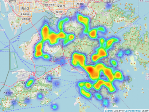
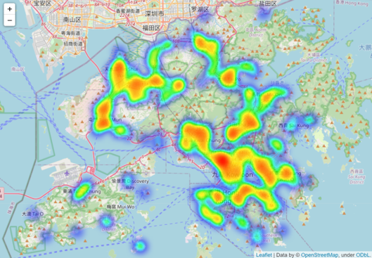
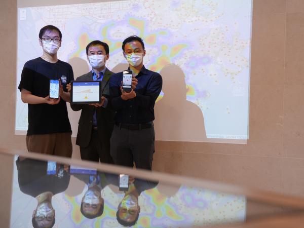
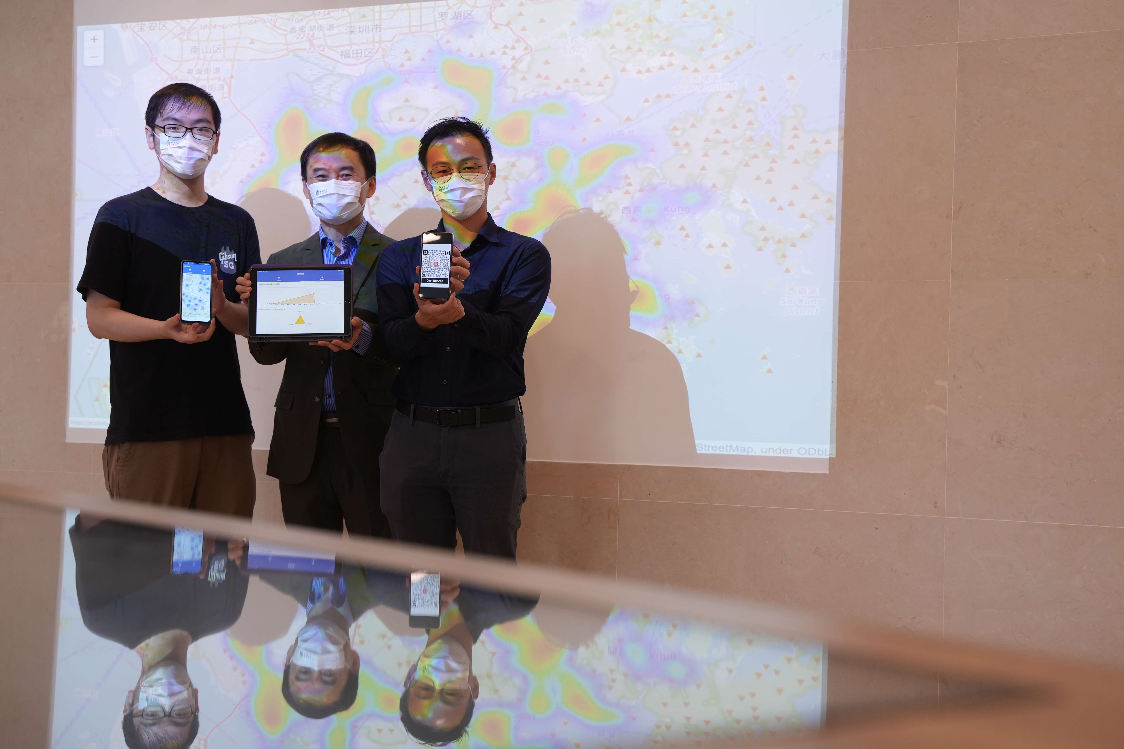
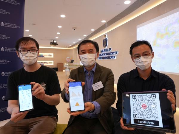
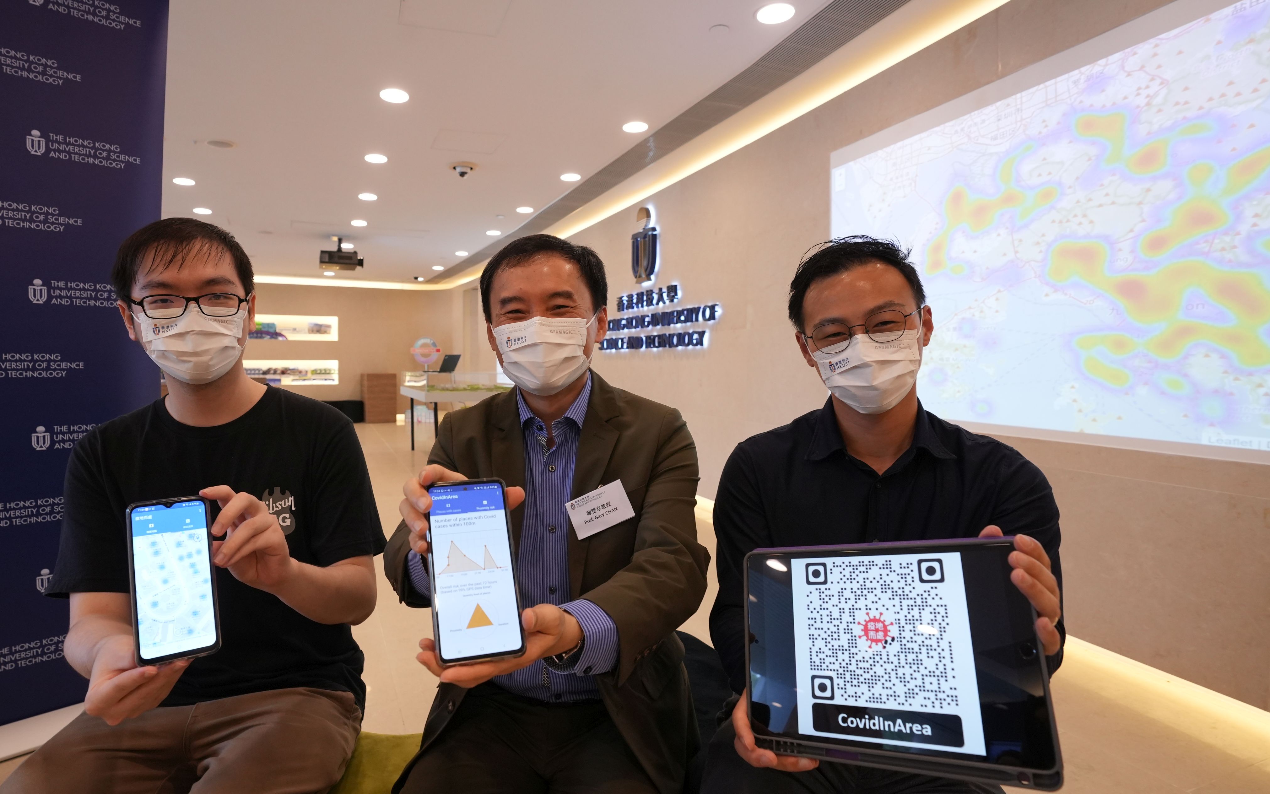
The Hong Kong University of Science and Technology (HKUST) has launched CovidInArea (information accessible through the project page https://proximity-risk-hk.github.io/), a privacy-preserving mobile-friendly app which integrates and visualizes the open data, “List of buildings visited by cases tested positive for SARS-CoV-2 virus in the past 14 days” (hereinafter referred as “incident places”), from the Department of Health (DoH) of HKSAR Government as an easily accessible heatmap, providing a free location-based tool for users to understand their risk due to proximity with the incident places.
Using big data mining and machine learning techniques, a team led by Prof. Gary CHAN Shueng-Han, Department of Computer Science and Engineering, has designed and developed the app, which consists of a real-time heatmap for browsing the locations of the incident places at a quick glance. Unlike other existing platforms and apps which mostly require users to check the locations manually, CovidInArea runs the check automatically by providing real-time GPS support for mobile users. It is the first public COVID-19 related app available in both Google Play Store and Apple App Store developed by a university for city-wide use anywhere in Hong Kong.
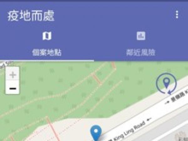
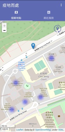
The heatmap pinpoints incident places given by DoH, based on data updated continuously according to government’s daily release. By zooming in and out on the heatmap, users can immediately gain a complete picture of the incident places, which are indicated by hues of different temperature, hence able to make informed decisions in their daily routine, path planning and keep safe distancing.
User privacy is ensured in CovidInArea, which requires no user registration and collects no personal information beyond GPS location. All computations are carried out with results presented locally on one’s phone, while the GPS location, once consumed, is immediately discarded without storage at any time.
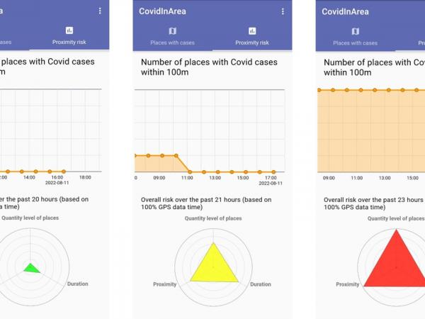
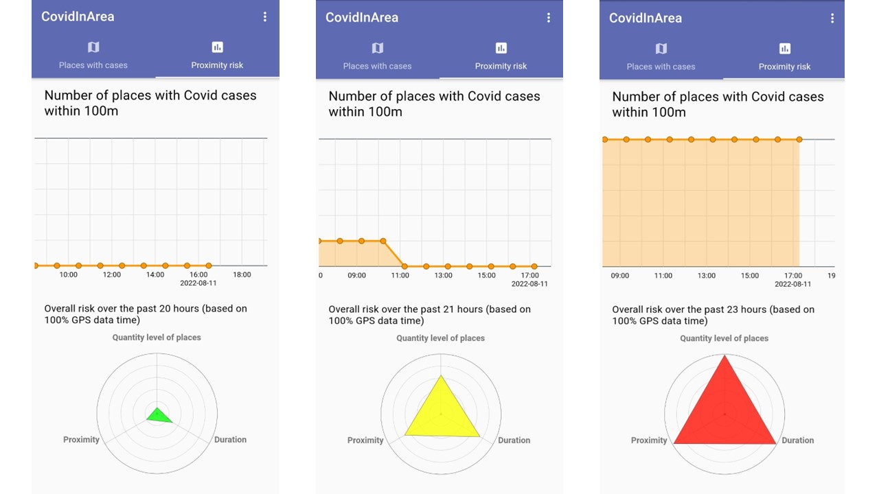
More importantly, with GPS on, users can easily visualize in a chart – over a period of several days – the number of incident places in their proximity in real time. Taking into consideration the distance, users’ dwell time, number of the incident places in proximity, the app also indicates the overall proximity risk using a color radar chart:
• Red: Overall high sustained contact with incident places. Recommended to reduce high-risk places, manage health and take voluntary testing if needed.
• Yellow: Medium risk. Be cautious. Plan safe paths to reduce risk.
• Green: Low risk. Stay vigilant.
Prof. Gary Chan said, “As the number of confirmed cases in Hong Kong has remained high recently, the app provides a timely and user-friendly reference on incident places to help citizens stay vigilant to their surroundings and take precautions if necessary to proactively reduce the infection risk while commuting. With CovidInArea, users may take appropriate actions to plan daily routes, manage their health, and keep safe distancing from the incident places. We thank the government for opening up the data for public use to fight against COVID-19 together.”
Prof. Gary Chan is an expert in developing novel and precise sensing and positioning technologies for smart applications. He worked with the government to develop a geo-fencing technology applied in StayHomeSafe app to enforce local home quarantine order. He has also innovated a privacy-preserving mobile app that senses registered Bluetooth signals to efficiently search for missing dementia patients in the city. His indoor navigation technology has also been deployed in many malls and venues.
CovidInArea is currently available in Google Play Store and Apple App Store in Hong Kong. For app installation, one may use his/her phone to visit this link, or scan the following QR code:
For media enquiries, please contact:
Anita Lam
Tel: 2358 6313
Email: anitalam@ust.hk
Lindy Wong
Tel: 2358 6306
Email: lindywong@ust.hk